En
Log in
All resources
Create a design
Tools
38,646 Free Artworks of Map
copper engraving print
british library
joan blaeu
1667 maps
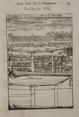
description de l'universe
alain manesson mallet
atlas maior, vol 8 (france ii and switzerland) - joan blaeu, 1667 - bl 114.h(star).8
atlas maior, vol 9 (italy) - joan blaeu, 1667 - bl 114.h(star).9
1667 maps of italy
atlas maior, vol 4 (netherlands) - joan blaeu, 1667 - bl 114.h(star).4
prints by abraham allard in the rijksmuseum amsterdam
maps in the rijksmuseum amsterdam
atlas maior, vol 7 (france i) - joan blaeu, 1667 - bl 114.h(star).7
1667 maps
atlas maior, vol 4 (netherlands) - joan blaeu, 1667 - bl 114.h(star).4
1667 maps
atlas maior, vol 6 (scotland and ireland) - joan blaeu, 1667 - bl 114.h(star).6
1667 maps
atlas maior, vol 8 (france ii and switzerland) - joan blaeu, 1667 - bl 114.h(star).8
1667 maps
atlas maior, vol 10 (spain and africa) - joan blaeu, 1667 - bl 114.h(star).10
1667 maps
atlas maior, vol 8 (france ii and switzerland) - joan blaeu, 1667 - bl 114.h(star).8
1667 maps
atlas maior, vol 4 (netherlands) - joan blaeu, 1667 - bl 114.h(star).4
1667 maps
atlas maior, vol 4 (netherlands) - joan blaeu, 1667 - bl 114.h(star).4
1667 maps
atlas maior, vol 7 (france i) - joan blaeu, 1667 - bl 114.h(star).7
1667 maps
atlas maior, vol 7 (france i) - joan blaeu, 1667 - bl 114.h(star).7
1667 maps
atlas maior, vol 11 (asia) - joan blaeu, 1667 - bl 114.h(star).11
1660s maps of turkey
atlas maior, vol 1 (northern europe, norway, and denmark) - joan blaeu, 1667 - bl 114.h(star).1
1667 maps
atlas maior, vol 10 (spain and africa) - joan blaeu, 1667 - bl 114.h(star).10
1667 maps
atlas maior, vol 9 (italy) - joan blaeu, 1667 - bl 114.h(star).9
1667 maps of italy
atlas maior, vol 6 (scotland and ireland) - joan blaeu, 1667 - bl 114.h(star).6
maps of idrone by gerardus mercator
atlas maior, vol 6 (scotland and ireland) - joan blaeu, 1667 - bl 114.h(star).6
1667 maps
atlas maior, vol 7 (france i) - joan blaeu, 1667 - bl 114.h(star).7
1667 maps
atlas maior, vol 6 (scotland and ireland) - joan blaeu, 1667 - bl 114.h(star).6
1667 maps
atlas maior, vol 8 (france ii and switzerland) - joan blaeu, 1667 - bl 114.h(star).8
1667 maps
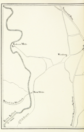
maps from the earth and its inhabitants, vol. iv
faversham creek
atlas maior, vol 8 (france ii and switzerland) - joan blaeu, 1667 - bl 114.h(star).8
1667 maps
atlas maior, vol 10 (spain and africa) - joan blaeu, 1667 - bl 114.h(star).10
1667 maps
atlas maior, vol 9 (italy) - joan blaeu, 1667 - bl 114.h(star).9
1667 maps of italy
atlas maior, vol 9 (italy) - joan blaeu, 1667 - bl 114.h(star).9
1667 maps of italy
atlas maior, vol 8 (france ii and switzerland) - joan blaeu, 1667 - bl 114.h(star).8
1667 maps
atlas maior, vol 4 (netherlands) - joan blaeu, 1667 - bl 114.h(star).4
1667 maps
atlas maior, vol 9 (italy) - joan blaeu, 1667 - bl 114.h(star).9
1667 maps of italy
atlas maior, vol 4 (netherlands) - joan blaeu, 1667 - bl 114.h(star).4
1667 maps
atlas maior, vol 6 (scotland and ireland) - joan blaeu, 1667 - bl 114.h(star).6
1667 maps
atlas maior, vol 9 (italy) - joan blaeu, 1667 - bl 114.h(star).9
1667 maps of italy
atlas maior, vol 1 (northern europe, norway, and denmark) - joan blaeu, 1667 - bl 114.h(star).1
1667 maps
atlas maior, vol 6 (scotland and ireland) - joan blaeu, 1667 - bl 114.h(star).6
1667 maps
atlas maior, vol 9 (italy) - joan blaeu, 1667 - bl 114.h(star).9
1667 maps of italy
atlas maior, vol 1 (northern europe, norway, and denmark) - joan blaeu, 1667 - bl 114.h(star).1
1667 maps
atlas maior, vol 8 (france ii and switzerland) - joan blaeu, 1667 - bl 114.h(star).8
1667 maps
atlas maior, vol 9 (italy) - joan blaeu, 1667 - bl 114.h(star).9
1667 maps of italy
atlas maior, vol 8 (france ii and switzerland) - joan blaeu, 1667 - bl 114.h(star).8
1667 maps
atlas maior, vol 4 (netherlands) - joan blaeu, 1667 - bl 114.h(star).4
1667 maps
atlas maior, vol 3 (germany) - joan blaeu, 1667 - bl 114.h(star).3
copper engraving print
atlas maior, vol 7 (france i) - joan blaeu, 1667 - bl 114.h(star).7
1667 maps
1890s maps of czechia
czech-language maps
1660s maps of france
maps of le mans
old maps of vermandois
maps by gerard valck
maps of the islands of greece by marco boschini (1658)
old maps of skiathos
maps of mons (hainaut) by braun & hogenberg
city walls of arras
algeria in the 1880s
old maps of algeria
maps from university of amsterdam special collections
atlas der neederlanden
maps from the earth and its inhabitants, vol. iv
19th-century maps of kent
maps from the earth and its inhabitants, vol. iv
old maps of hastings, england
maps from the earth and its inhabitants, vol. iv
old maps of newcastle upon tyne
maps from the earth and its inhabitants, vol. iv
old maps of the isle of arran
maps from the earth and its inhabitants, vol. iv
1870s maps of london
wały jagiellońskie street in gdańsk
maps of gdańsk by braun & hogenberg
historical images of graben (vienna)
map of vienna by jacob hoefnagel
eran laor cartographic collection
giovanni maria cassini
eran laor cartographic collection
tranquillo mollo
codex arundel (c.1480-1518) - bl arundel ms 263
sketches of the moon
1834 in galicia (spain)
galiciana
prints by ambrogio brambilla
old maps of parma
maps in the topographia austriacarum (merian)
baroque
a.de la motraye's travels through europe, asia, and into part of africa (1723) by la mottraye
realism
history of samarkand
maps of samarkand
charles william meredith van de velde
eran laor cartographic collection
maps by johannes vingboons
old maps of kochi, kerala
maps by william home lizars
1810s maps of the world
florence h. woolward - the genus masdevallia
david rumsey historical map collection
maps of basel by braun & hogenberg
hamburgische elbkarte von melchior lorichs
maps of buxtehude
eran laor cartographic collection
adolf eltzner
old maps of île saint-louis
maps of paris in the 1740s
lucas achtschellinck
baroque
old maps of the sea of galilee
french-language maps
maps of aden by braun & hogenberg
aden
maps from university of amsterdam special collections
atlas der neederlanden
abraham cresques
catalan atlas
crystal palace in sydenham
victorian architecture
rivalry between cologne and düsseldorf
maps of cologne by braun & hogenberg
maps of husum by braun & hogenberg
schloss vor husum
1890s maps of central america
1890s maps of the caribbean
geological maps of pennsylvania
1885 maps of pennsylvania
17th-century maps of pembrokeshire
old county maps of pembrokeshire
maps of paris from the stanford libraries
1784 maps of france
old maps of haarlem
ideal city
geographia universalis (1545) in the british museum
german renaissance,northern renaissance
description de l'universe
comets in art
description de l'universe
africa in art
19th-century maps of south australia
australia (1873) by booth
description de l'universe
1685 in spain
description de l'universe
africa in art
19th-century maps of victoria, australia
australia (1873) by booth
australia (1873) by booth
1870s maps of australia
our arctic province, alaska and the seal islands (1886)
old maps of alaska
john rocque's 1748 map of london and adjacent country
a history of london (1884)
description de l'universe
alain manesson mallet
description de l'universe
alain manesson mallet
description de l'universe
alain manesson mallet
the cruise of the marchesa (1889)
19th-century maps of sulawesi
in the volcanic eifel. a holiday ramble (1896)
old maps of eifel
bolivia in the 17th century
description de l'universe
19001 - 19100 of 38,646
Next page
/ 387