En
Log in
All resources
Create a design
Tools
80,432 Free Images of Service
maps from the earth and its inhabitants, vol. iv
maps from the earth and its inhabitants, vol. xvi
maps from the earth and its inhabitants, vol. x
maps from the earth and its inhabitants, vol. xiii
maps from the earth and its inhabitants, vol. vii
maps from the earth and its inhabitants, vol. xiv
maps from the earth and its inhabitants, vol. xviii
frank leslie's scenes and portraits of the civil war (1894)
frank leslie
maps from the earth and its inhabitants, vol. xv
maps from the earth and its inhabitants, vol. xvi
surveying in mexico
maps from the earth and its inhabitants, vol. iv
maps of balmoral castle
maps from the earth and its inhabitants, vol. vii
19th-century maps of korea
maps from the earth and its inhabitants, vol. xv
first nations people of british columbia
maps from the earth and its inhabitants, vol. iv
19th-century maps of derbyshire
maps of rivers of south sudan
sobat river
maps from the earth and its inhabitants, vol. iv
old maps of hastings, england
maps from the earth and its inhabitants, vol. xvi
maps of the history of mexico
19th-century maps of sierra leone
maps of rivers of sierra leone
the century book of famous americans - the story of a young people's pilgrimage to historic homes (1896)
engravings of abraham lincoln
maps from the earth and its inhabitants, vol. vi
pyatigorsk
maps from the earth and its inhabitants, vol. iv
maps of snowdonia
maps from the earth and its inhabitants, vol. v
maps of the north atlantic
from edinburgh to the antarctic. an artist's notes and sketches during the dundee antarctic expedition of 1892-93
port stanley, ontario
maps from the earth and its inhabitants, vol. xvii
french louisiana
maps from the earth and its inhabitants, vol. xi
maps indicating exploration
maps from the earth and its inhabitants, vol. vii
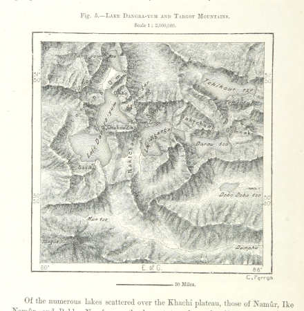
targot mountains
maps from the earth and its inhabitants, vol. viii
british india
historical collections of the state of new jersey (1852)
maps of trenton, new jersey
maps from the earth and its inhabitants, vol. iv
1870s maps of london
maps from the earth and its inhabitants, vol. iv
sewers in london
maps from the earth and its inhabitants, vol. viii
ghats
maps from the earth and its inhabitants, vol. xiv
1870s maps of indonesia
rivers of the western cape
maps of the western cape
maps from the earth and its inhabitants, vol. x
rosetta (egypt)
maps from the earth and its inhabitants, vol. vi
population density maps of europe
maps from the earth and its inhabitants, vol. iv
old maps of leeds
maps from the earth and its inhabitants, vol. iv
19th-century maps of the english channel
maps from the earth and its inhabitants, vol. xi
1870s maps of algeria
maps of ardabil province
maps of sabalan
maps from the earth and its inhabitants, vol. iv
lowestoft
maps from the earth and its inhabitants, vol. xiii
1870s maps of africa
maps from the earth and its inhabitants, vol. iv
1870s maps of scotland
maps from the earth and its inhabitants, vol. iv
milford haven
maps from the earth and its inhabitants, vol. iv
rhins of galloway
maps from the earth and its inhabitants, vol. x
john hanning speke
maps from the earth and its inhabitants, vol. vii
charles eugène perron
maps from the earth and its inhabitants, vol. vii
yarlung tsangpo
maps from the earth and its inhabitants, vol. iv
old maps of swansea
maps from the earth and its inhabitants, vol. xiv
old maps of sydney
maps from the earth and its inhabitants, vol. x
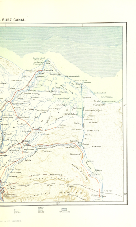
19th-century maps of the nile delta
harpers ferry, west virginia
1861 in virginia
maps from the earth and its inhabitants, vol. x
maps of weather and climate of africa
maps from the earth and its inhabitants, vol. vii
provinces of japan
maps from the earth and its inhabitants, vol. xiv
maps of voyages
maps from the earth and its inhabitants, vol. xviii
transport in south america
1870s maps of venezuela
1878 in venezuela
maps from the earth and its inhabitants, vol. xvii
old maps of washington, d.c.
frank leslie's scenes and portraits of the civil war (1894)
hilton head island, south carolina
maps from the earth and its inhabitants, vol. iv
1870s maps of wales
maps from the earth and its inhabitants, vol. xvi
jorullo
maps of natal colony
maps of zululand
files from 115892967@n03 flickr stream
maps from the earth and its inhabitants, vol. iv
ecclesiastical maps
albert henry barnes
fields
posters in the rijksmuseum amsterdam
theo molkenboer
frank leslie's scenes and portraits of the civil war (1894)
american civil war in 1862
coats of arms of ciocchi del monte family
giorgio andreoli
the apotheosis of washington (brumidi)
the apotheosis of washington
maps from the earth and its inhabitants, vol. v
denmark in the 19th century
frank leslie's scenes and portraits of the civil war (1894)
american civil war in 1862
maps from the earth and its inhabitants, vol. xiii
maps of journeys
old maps of saint-louis (senegal)
orientalist painting
maps from the earth and its inhabitants, vol. xv
temperature maps of north america
maps from the earth and its inhabitants, vol. xii
19th-century maps of the azores
maps from the earth and its inhabitants, vol. xiv
old maps of sydney
maps from the earth and its inhabitants, vol. xviii
1870s maps of peru
maps from the earth and its inhabitants, vol. iv
19th-century maps of cornwall
maps of crossings of the atlantic ocean
1890s maps of the atlantic ocean
maps from the earth and its inhabitants, vol. xvi
1870s maps of mexico
maps from the earth and its inhabitants, vol. iv
1870s maps of london
historical collections of the state of new jersey (1852)
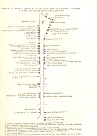
maps of newark, new jersey
maps from the earth and its inhabitants, vol. vi
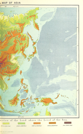
topographic maps of asia
maps from the earth and its inhabitants, vol. xiii
maps indicating exploration
illiteracy in france
education in france
maps from the earth and its inhabitants, vol. xviii
old maps of valparaíso
maps from the earth and its inhabitants, vol. viii
maps of the mekong
maps from the earth and its inhabitants, vol. iv
cirencester
maps from the earth and its inhabitants, vol. xiii
19th-century maps of madagascar
correspondence of the national park service
north carolina monument, gettysburg
maps from the earth and its inhabitants, vol. iv
old maps of windsor
maps from the earth and its inhabitants, vol. iv
maps of tides
19th-century maps of namibia
maps of walvis bay
maps from the earth and its inhabitants, vol. iv
maps of the humber estuary
maps from the earth and its inhabitants, vol. iv
maps of rochester, kent
maps from the earth and its inhabitants, vol. xvi
old maps of central america
maps from the earth and its inhabitants, vol. xv
hydrological maps of the united states
maps from the earth and its inhabitants, vol. xvi
19th-century maps of mexico city
maps from the earth and its inhabitants, vol. xvi
19th-century maps of jamaica
maps from the earth and its inhabitants, vol. ii
st malo
maps from the earth and its inhabitants, vol. iv
charts of plymouth sound
westmorland, cumberland, durham, and northumberland (1858)
old maps of westmorland
maps from the earth and its inhabitants, vol. xvii
linguistic maps of north america
maps from the earth and its inhabitants, vol. v
1870s maps of finland
maps from the earth and its inhabitants, vol. xviii
maps of indigenous territories of colombia
maps of the districts of the canton of bern
biel/bienne (administrative district)
hamburg: historisch-topographische und baugeschichtliche mittheilungen
marmorkapelle (schröderstift)
maps from the earth and its inhabitants, vol. xi
oases of libya
maps from the earth and its inhabitants, vol. x
19th-century maps of the nile delta
maps from the earth and its inhabitants, vol. x
maps of lake victoria
33901 - 34000 of 80,432
Next page
/ 805